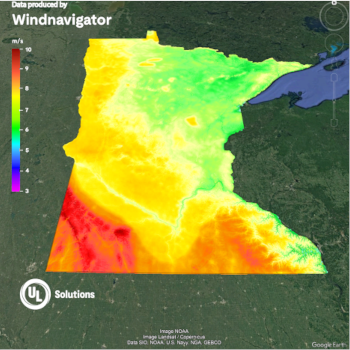
Wind Data Maps, Statistics & KML files
With our data provided in standard GIS compatible formats you can work with your preferred spatial analysis platform to conduct in-depth analysis and create maps.
Raster Data included
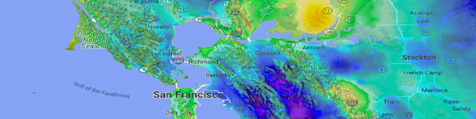
- Format: GeoTIFF
- Resolution: 200m
- Annual Average Wind Speed at user defined hub heights
- Digital Elevation Model (DEM)
- Roughness
|
|
KML file of Wind Speed
- Format: KMZ
- Resolution: 200m
- Annual Average Wind Speed at user defined hub heights
|
|
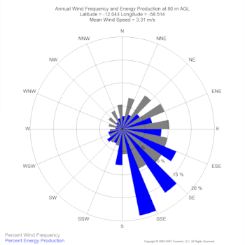
Vector Data included
- Format: ESRI Point Shapefiles (.shp)
- Resolution: 2km
- Wind Distribution Data: Includes wind speed, power, Weibull A and k, and frequency percentages in 1 m/s bins.
- Wind Rose: Frequency and speed in 16 direction sectors.
- Monthly Data: Includes average annual wind speeds by month.
- Diurnal Data: Includes average annual wind speeds by hour.
|
|
Download Wind Speed Sample Data
Integrate this data with Openwind to determine your offsets and developable areas.